1 / 2
1972 Press Photo US Geological Survey scientists study quake area of Managua
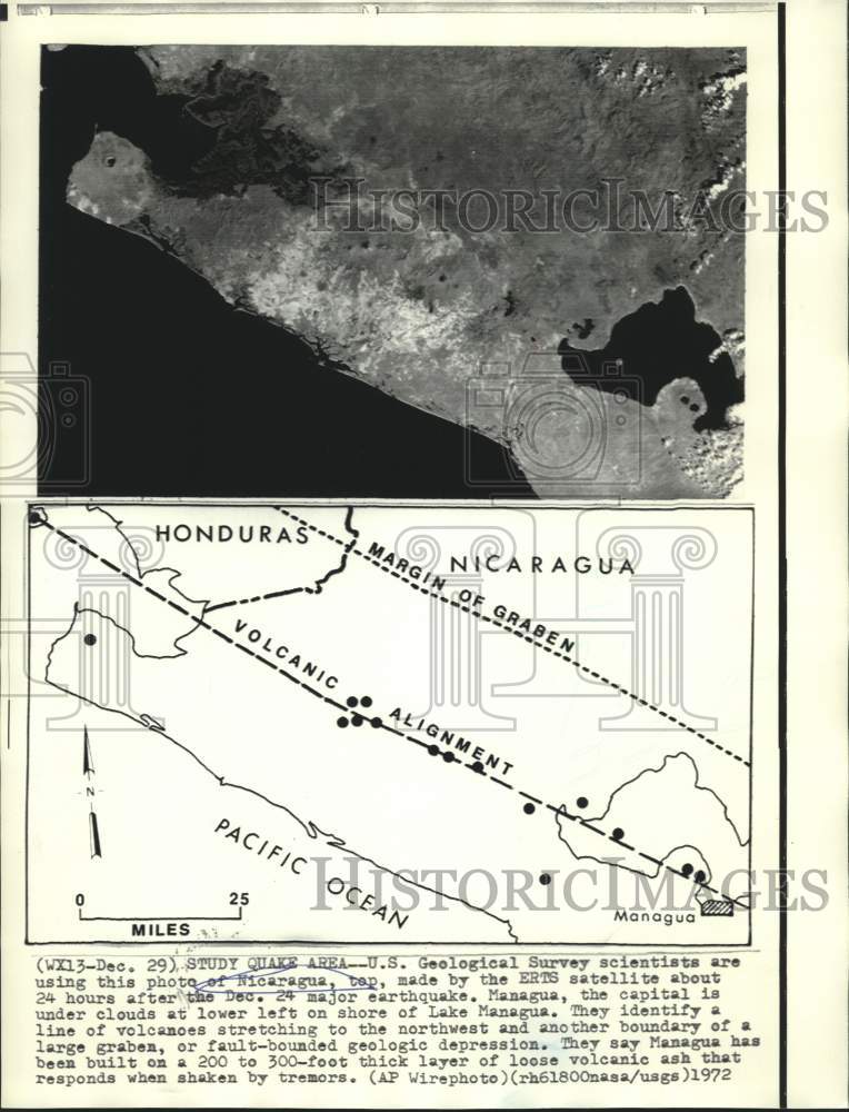
U.S. Geological Survey scientists are using this photo of Nicaragua, top, made by the ERTS satellite about 24 hours after the December 24 major earthquake. Managua, the capital is under clouds at lower left on shore of Lake Managua. They identify a line of volcanoes stretching to the northwest and another boundary of a large graben, or fault-bounded geologic depression. They say Managua has been built on a 200 to 300-foot thick layer of loose volcanic ash that responds when shaken by tremors.
Photo is dated 1972.
Photo measures 8 x 10.5 inches.
Photo is dated 1972.
Photo measures 8 x 10.5 inches.
$19.99
1972 Press Photo US Geological Survey scientists study quake area of Managua—
$19.99
Product Information
Product Information
Shipping & Returns
Shipping & Returns
Description
U.S. Geological Survey scientists are using this photo of Nicaragua, top, made by the ERTS satellite about 24 hours after the December 24 major earthquake. Managua, the capital is under clouds at lower left on shore of Lake Managua. They identify a line of volcanoes stretching to the northwest and another boundary of a large graben, or fault-bounded geologic depression. They say Managua has been built on a 200 to 300-foot thick layer of loose volcanic ash that responds when shaken by tremors.
Photo is dated 1972.
Photo measures 8 x 10.5 inches.
Photo is dated 1972.
Photo measures 8 x 10.5 inches.